Creating the Western Shield World
Eight authors, one world. How did our cartographer do it?
Written by Reordan J Carey
Let’s take a look at an imaginary world.
Seriously. Grab your copy of Tales of Ale and Chainmail: Volume 1 and, after admiring the sweeping vines of the cover, gently open it. Flip past the title page, and leaf through the front matter until… there! What is that? it's… a map, a bird’s eye view of a place that doesn’t exist. Take a good look, see the cities enshrouded by mountains, the meandering coast, the lush and bountiful forests and the myriad roads. As you read onward you will keep turning back to that map, working out where Holfur’s Cauldron is, how long travel should take from Teclusis to Helvenica, or how the mountains near Albunath separate it from the frozen north.

"Who drew this map?" you may ask as you gaze at it, wonderingly, "how did they know where to put Kettleheim and Ironvale. Why is it slanted, and who the hell calls a town with a well 'Wellington'."
This, inquisitive reader, is where I step in.
My name is Reordan J Carey. I’m an Illustrator and writer working out of southeast Queensland, with a passion for anything fantasy and ephemera; old maps, newspapers, letters, documents all with a mythic or fantasy slant. When I was asked by Renee to create the map of the Western Shield World for Tales, I knew it would be an involved and insightful task.
So, how does one map out a non-existent world, devised by eight separate authors, and keep it cohesive? Well, let’s look at the history of creative cartography.
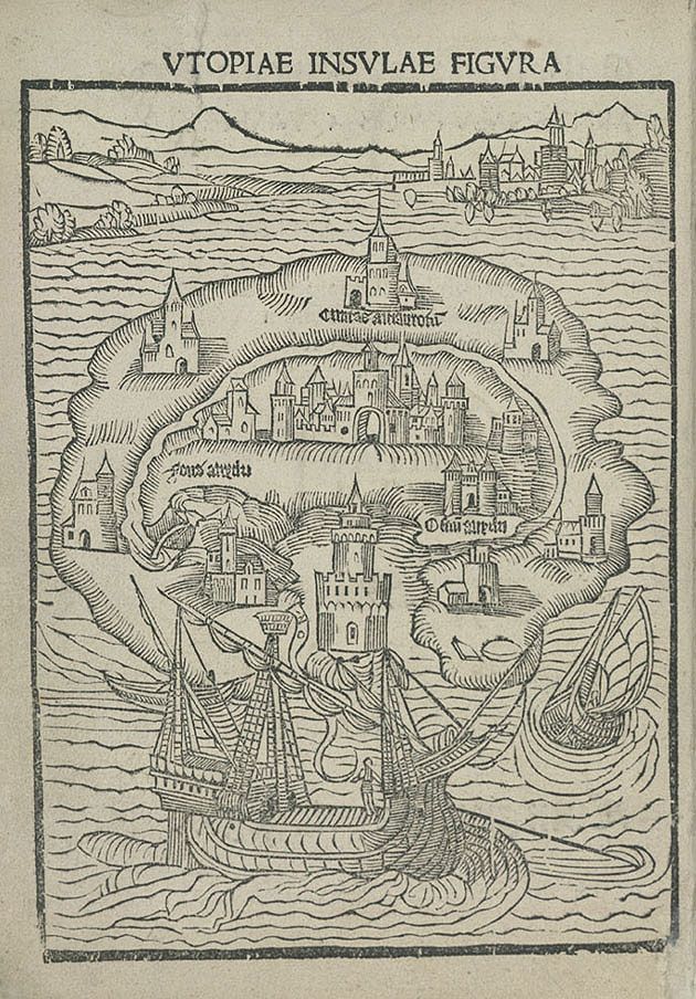
Many fantasy books have maps these days, and the maps of Tolkien’s Middle-Earth are often the primary inspiration for later fantasy cartography. One of the oldest fantastical maps is the 1516 woodcut map of the titular island of Sir Thomas More’s Utopia (Not to be confused with our wonderful Thomas D Moore). Though revised many times over the centuries, assigning rational geography to More’s near nonsensical descriptions of the enclosed bay and the 54 city states of the Island has been challenging.
But Tales has multiple authors’ intents to consider and collate. One of the earliest examples of collaborative creative cartography was the creation of Verdopolis (The Glass Town Federation) by the Brontë siblings in their youth. Though rife with colonial musings in an exoticized West Africa, the Brontë’s each wrote stories set in this shared fantastical world, reacting and building off each other’s creations.
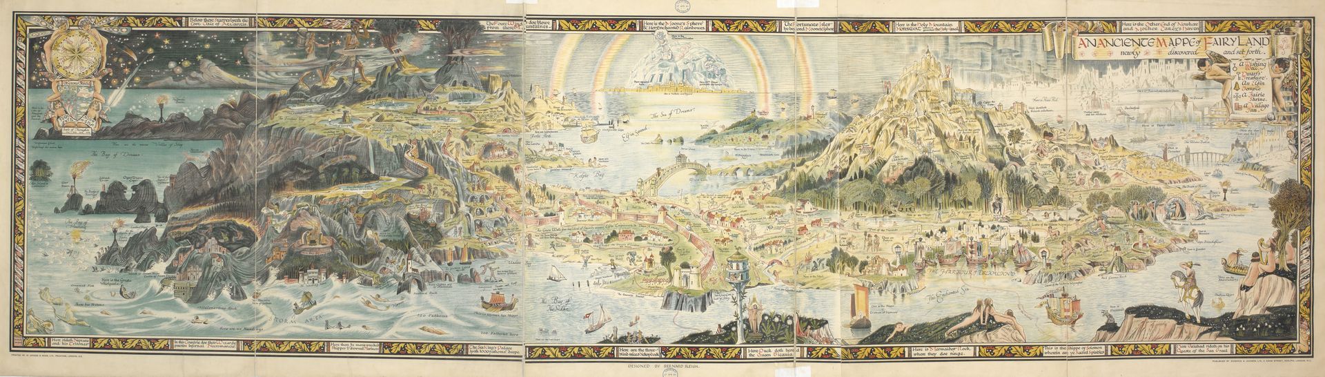
A more whimsical example might be Bernard Sleigh’s 1917
Ancient Mappe of Fairyland, created for his children to create a singular space for their favourite fairytales to coexist and play out: from Peter Pan to Puss in Boots, Camelot to Asgard, each connected by beautiful Vistas and fantastical geography.
So, I had my format. Something with the ornament and tradition of More’s Utopia, with the recognised style of Tolkien’s Middle Earth, and the anthological aspects of Sleigh’s Fairyland and the Brontës’ Verdopolis (sans the rampant Colonialism, of course), all while being a believable navigational aid within the Western Shield World.
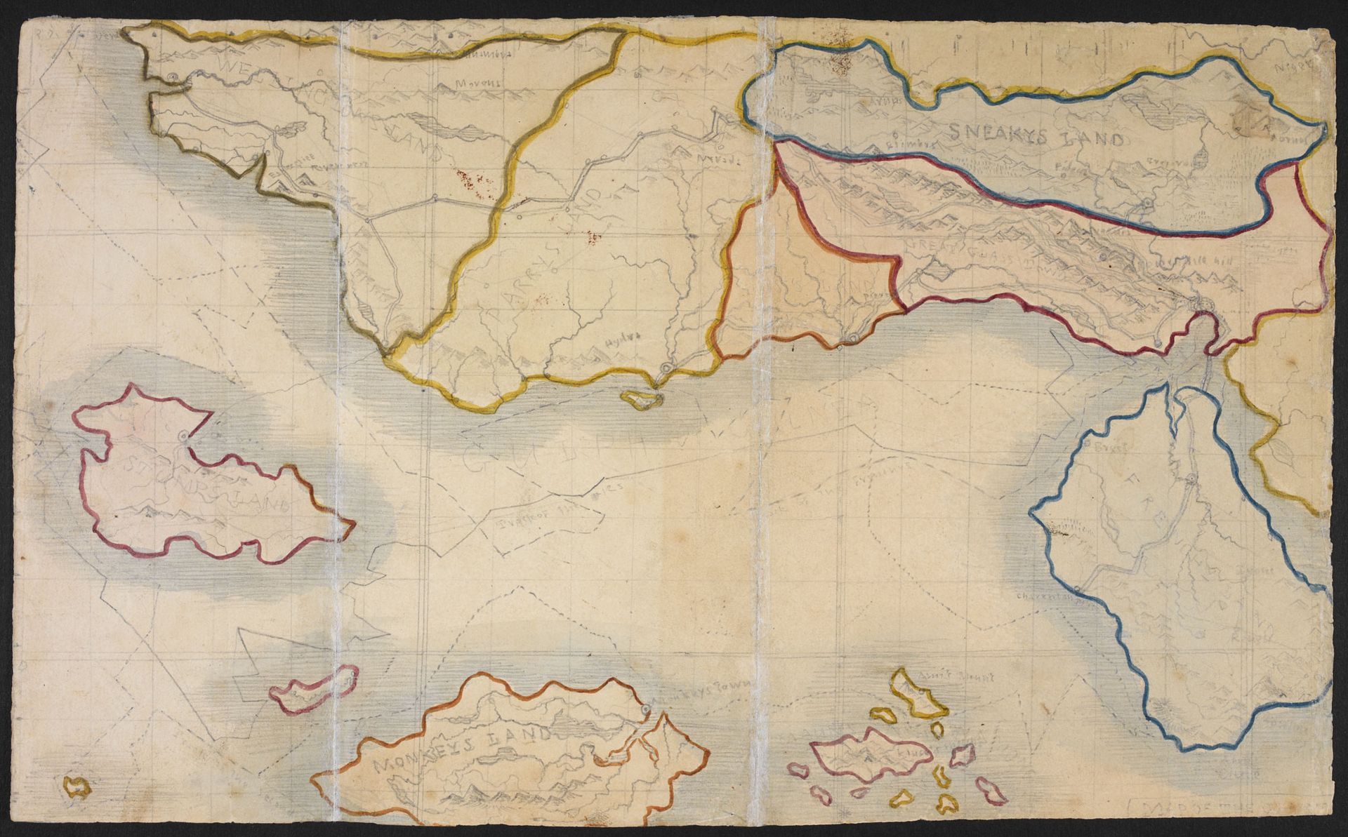
I could romanticise the process for devising each location with the eight authors, that I travelled through their works gleaning cartographical data as if studying their peaks and shorelines from the prow of a great ship, but I must admit that spreadsheets were imperative in this endeavour.
Each author provides locations and landmarks, the climates they were situated in and distances or obstacles between them. Analysing this, I knew Helvenica sat on a peninsula, that Teclusis was across the sea and that Frogchester was 50 miles from Mount Reckless in the northern tundra. I tilted the map's cardinal Axis about 17° clockwise to fit the range of climates from boreal to sub-tropical. With the unnamed town and city in Lucina Nyx’s Grit and Glimmer, she described them as connected by a river with mountains to the east, so I placed them within the pre-established geography of north-western Albunath.
On names, I often need more to fill out the map than have already been written in the text, so I enjoy interesting and informational names in the manner of Thomas More (Utopia from the Greek Ou-Topos, literally ‘No Place’ or ‘Nowhere’). Take the unnamed settlements from Grit and Glimmer; Avonmont is formed from the Welsh ‘Afon Monadh’ (literally ‘River-mountain’) and Haltide, where the river meets the sea, and the ‘Tide Halts’.
Finally, I worked on the artistic details, carving out mountain ranges, sprouting forests and assembling cities, illustrating the eight magical artefacts from each story and weaving them into the border of the map, encircling the world, and tying each location to its magical object. After the finishing touches such as hand lettering and the lightly folded texture behind the map, it was done.
Sometimes maps can affect the stories themselves. I am told during the editing process the unnamed town in Brewing Storm was shifted to Kettleheim, and given its location on the map, allowed the use of volcanic Teclusis to explain dangers with travel.
Creating this Map for the Tales anthology was incredibly rewarding, working with amazing authors and the incredible team at SkyNation Publishing to ensure it would delight both authors and readers alike. The process allowed me to be creative while also delving into cartographic research and learning many new skills. Hopefully, next time you peek at a map tucked into the start of a fantasy book, you’ll think about what goes into making them, and you’ll smile a little every time you turn back to figure out where our intrepid adventurers are now.
Reordan J Carey, Cartographer for Tales of Ale and Chainmail